Madeira is a Portuguese island in the Atlantic Ocean 600 miles west of Morocco. It is volcanic, and roughly 50 miles long (east to west) and 25 miles wide (north/south). This was an important island for the Portuguese trade routes around Africa to India and Japan, and then on the way to the new world, starting with Christopher Columbus.

Like many volcanic islands, the terrain is steep and formidable, and with a good supply of rain, much of the island is covered with foliage. In the lowlands, hydrangeas are in full bloom here and grow like weeds. Higher in the mountains we saw many flowering Echium candicans (native to Madeira) being worked by bumble bees.
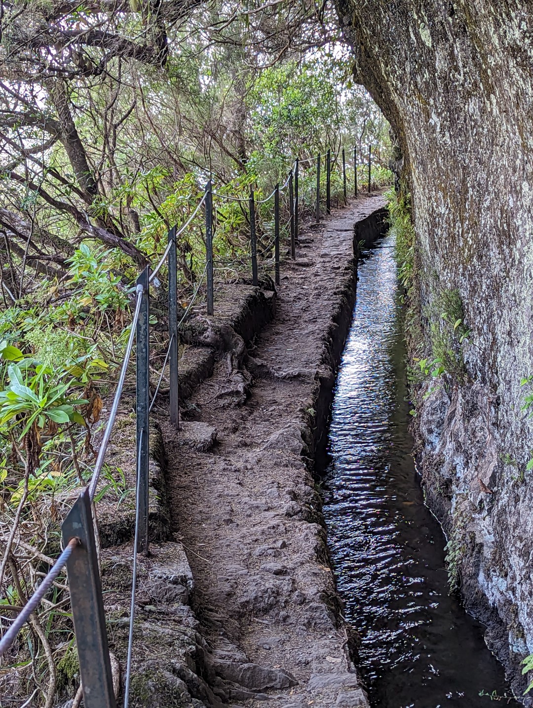
Starting in the 15th century, inhabitants built irrigation canals (levadas) to bring water from high in the central mountains to farmable land, initially to farm sugar cane. Canal building continued into the mid-20th century. There are hundreds of miles of these canals now and many are still in use. Sections of these canals pass through beautiful terrain, sometimes carved into otherwise vertical faces of the mountains, passing through tunnels at times. Hiking along the levadas and other trails has become a popular tourist attraction.
We arranged our lodging and transportation and the hike itinerary through a tour company called InnWalking. We spent two nights in Machico, two nights in Santana, and after the last hike, back to Funchal. Our five hikes were all in the eastern and middle parts of the island. Each hike was unique and beautiful.
Before and after the hikes we spent time exploring Funchal and other parts of the island, more on that later.
Ponta de São Lourenço
This is a dry peninsula on the southeast corner of the island. No canals here, but lots of beautiful rock formations. This hike happened to coincide with the record hottest June day in Madeira, so the hike was a bit warm and sweaty, but with a great sea breeze.


Portela to Ribeiro Frio
A beautiful inland hike mostly along a levada leading to it’s source at Ribeiro Frio.


Boca do Risco to Porto da Cruz
A hike along an inland levada, then out to the northern coast and along the face of the steep mountains the form the coastline. Panoramic ocean views from several hundred meters high, then a long descent to the port town of Porto da Cruz.


Queimadas to Caldeiro Verde then to the town of Ilha
Levadas carved into vertical mountain walls, tunnels, and then into a caldera. The Green Caldera is a uniquely beautiful location with a ribbon of waterfall crashing into a pool of water, surrounded on three sides by vertical walls covered in plants.
The hike doubled back towards the origin, but then took a turn onto a less-used, sometimes overgrown and steep trail down to the small town of Ilha.


Teixeira to Pico Ruivo, and Pico Arieiro
A strenuous hike mostly up and down, often steep with lots of stairs, and some good vertigo moments walking on ridge lines with drops on both sides. Both peaks are aound 6000 ft. in elevation. Panoramic views from start to finish, well above the clouds.


There are often steep drops off the side of the levadas, which are hard to notice most of the time because the thick vegetation that grows up next to the path. But sometimes you get a clear view:
We really enjoyed our hikes, and we also really enjoyed some down time after finishing. Next up, a few more days in Madeira, then on to the Azores!
Leave a Reply